

Herb’s Blog, Herbdate 22558 – 871
Here’s the haps:
The last time I had tried to embed a map in a post I wound up having problems with everyone being able to see it. I’m going to try it again because if you look at the hairpin turns and the mountainous terrain you will understand the kind of slow drive we took to go to Aspen, Colorado from Colorado Springs, Colorado. I was kind of surprised that Google Maps would not plot the drive but then I realized that this road, Colorado Highway 82, is closed from October to May. I used Bing Maps, which allowed me to future date my search, and the computer says that from Colorado Springs to Maroon Bells Welcome Center is 160 miles, 3 hours and 45 minutes. It actually takes at least 5 or more hours. The worst part is getting to the top of the pass because the road goes every which way and you cannot drive at even close to the posted limit of 35 mph. This is because of the terrain.

My son stopped early in the morning and picked up a couple of hitchhikers(Grab the little slider arrow to switch between two pics.):


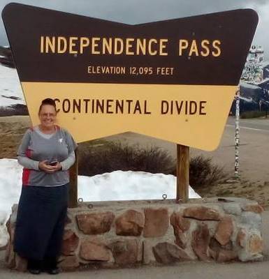
I’m sorry we did not get more pictures of the road itself but we were trying to drive and it required some concentration and focus. While there were guard rails for the most part there were stretches that had none. Eventually, we came to the top of the pass. Surprised by snow and ice in July in North America? It is quite a lot colder in the mountains the higher up you go.


There are hiking trails, paved and dirt, all over here with informational plaques all around, if you are looking for a real Colorado Rocky Mountain High.


Tomorrow: The Bells, The Bells…but sorry, no tintinnabulation.











I like comments and try to respond to them all if I can: